
To find the book, map or guide you are looking for, first select the area you are interested in by moving your mouse over the map and then click on a region to view our range.


OS Explorer Maps
Every part of England, Scotland and Wales is covered by 403 maps that include National Trails, Recreational Paths, picnic areas, viewpoints and selected places of interest. In addition, there's Rights of Way information for England and Wales.
To select the Ordnance Survey map you require, first select the map number or area you are interested in by moving your mouse over the map and then click on the number to open the relevant page.


OL43 - Hadrian's Wall area Explorer Active Map
1:25 000 scale (4 cm to 1 km 2.5 inches to 1 mile) The essential map for outdoor activities.
Price: £13.99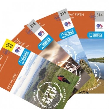
OS ACTIVE MAPS - waterproof
The 84-mile Hadrian's Wall Path is a National Trail that connects the
quiet town of Bowness-on-Solway on the west coast to the ex-shipbuilding
town of Wallsend near the bustling city of Newcastle-upon-Tyne in the
north-east.
SAVE MONEY with this bundle of FOUR Explorer maps that cover every step of the route.

Every part of England, Scotland and Wales - however remote - is covered by 403 maps specially designed for walkers, off-road cyclists, horse riders and all involved in outdoor activities.
Price: £10.99
OS Explorer Map 102 Lands End
Map sheet number 102 in the OS Explorer map series is the perfect map for discovering the famous area around Lands End, Penzance and St Ives. The area is well known as the most extreme south westerly point in Britain.

OS Explorer Map 103 The Lizard
Map sheet number 103 in the OS Explorer map series is the ideal map to use when exploring the area around The Lizard, Falmouth and Helston. Plenty of coastal walks and hiking opportunities on Goonhilly Downs.

OS Explorer Map 104 Redruth...
Map sheet number 104 in the OS Explorer map series is the ideal map for walkers, cyclists and holiday makers visiting Redruth and St Agnes. The Cornish coastline that dominates this area is perfect for outdoors enthusiasts and holds many attractions.
Price: £10.99
Map sheet number 105 in the OS Explorer map series is the ideal map for walks, hikes and rides around Falmouth, Mevagissey, Truro and St Mawes. The South West Coast Path is an ideal way to explore the coastline in this part of Cornwall.

OS Explorer Map 106 Newquay...
Map sheet number 106 in the OS Explorer map series is the ideal map for anyone wishing to visit the Cornish coastal towns of Newquay and Padstow. The area is famous amongst holiday makers and is frequented by hikers, surfers and people wishing to sample the delights of the local towns and villages.

Map sheet number 107 is the perfect map for anyone wishing to explore the area of St Austell and Liskeard. With lots of secluded bays, national trails and attractive towns the area is the ideal place for a Cornish holiday or day trip.

Every part of England, Scotland and Wales - however remote - is covered by 403 maps specially designed for walkers, off-road cyclists, horse riders and all involved in outdoor activities.
Price: £10.99
Map sheet number 109 in the OS Explorer map series is the ideal map for planning a trip to Bodmin Moor and the areas in and around Camelford and Liskeard. Bodmin Moor is dominated by granite tors and the open plateau is great for active adventures.
Price: £10.99
OS Explorer Map 110 Torquay...
Map sheet number 110 in the OS Explorer map series is the perfect map for exploring the eastern edge of Dartmoor national park and the coastal areas of Torquay, Dawlish and Paignton.

Map sheet number 111 in the OS Explorer map series is the perfect map to use when walking, cycling or camping in Bude, Boscastle and Tintagel. All three towns can be experienced when following the South West Coast Path.

Every part of England, Scotland and Wales - however remote - is covered by 403 maps specially designed for walkers, off-road cyclists, horse riders and all involved in outdoor activities.
Price: £10.99
OS Explorer Map 113 Okehampton
Map sheet number 113 in the OS Explorer map series is ideal for discovering the Hatherleigh, North Tawton and Lapford area around the north of Dartmoor national park. This area of Devon is rich in countryside and therefore perfect for all those who are passionate about their outdoor activities.

Every part of England, Scotland and Wales - however remote - is covered by 403 maps specially designed for walkers, off-road cyclists, horse riders and all involved in outdoor activities.
Price: £10.99
OS Explorer Map 115 Exmouth...
Every part of England, Scotland and Wales - however remote - is covered by 403 maps specially designed for walkers, off-road cyclists, horse riders and all involved in outdoor activities.
Price: £10.99
Every part of England, Scotland and Wales - however remote - is covered by 403 maps specially designed for walkers, off-road cyclists, horse riders and all involved in outdoor activities.
Price: £10.99
Every part of England, Scotland and Wales - however remote - is covered by 403 maps specially designed for walkers, off-road cyclists, horse riders and all involved in outdoor activities.
Price: £10.99
Every part of England, Scotland and Wales - however remote - is covered by 403 maps specially designed for walkers, off-road cyclists, horse riders and all involved in outdoor activities.
Price: £10.99
Every part of England, Scotland and Wales - however remote - is covered by 403 maps specially designed for walkers, off-road cyclists, horse riders and all involved in outdoor activities.
Price: £10.99
OS Explorer Map 120 Chichester
Every part of England, Scotland and Wales - however remote - is covered by 403 maps specially designed for walkers, off-road cyclists, horse riders and all involved in outdoor activities.
Price: £10.99
OS Explorer Map 121 Arundel...
Every part of England, Scotland and Wales - however remote - is covered by 403 maps specially designed for walkers, off-road cyclists, horse riders and all involved in outdoor activities.
Now known as OL 10

Every part of England, Scotland and Wales - however remote - is covered by 403 maps specially designed for walkers, off-road cyclists, horse riders and all involved in outdoor activities.
Price: £10.99
Every part of England, Scotland and Wales - however remote - is covered by 403 maps specially designed for walkers, off-road cyclists, horse riders and all involved in outdoor activities.
Price: £10.99
Every part of England, Scotland and Wales - however remote - is covered by 403 maps specially designed for walkers, off-road cyclists, horse riders and all involved in outdoor activities.
Price: £10.99
Every part of England, Scotland and Wales - however remote - is covered by 403 maps specially designed for walkers, off-road cyclists, horse riders and all involved in outdoor activities.
Price: £10.99
Every part of England, Scotland and Wales - however remote - is covered by 403 maps specially designed for walkers, off-road cyclists, horse riders and all involved in outdoor activities.
Price: £10.99
Every part of England, Scotland and Wales - however remote - is covered by 403 maps specially designed for walkers, off-road cyclists, horse riders and all involved in outdoor activities.
Price: £10.99


