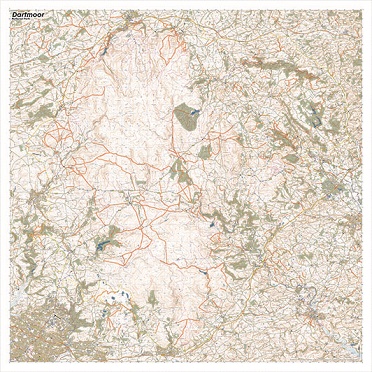
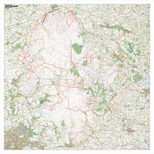
Our larger size Dartmoor SplashMap covers the entire park at a scale of 1:40 000. Visit the Tors and the ancient stone monuments in this wild country. And get yourself from A to B using some of the clearest cartography youve ever seen. Our map is printed onto a waterproof fabric. It can be worn as a scarf or stuffed in a pocket. Theres no need to carefully fold. The content of our Dartmoor map includes highlighted bridle ways and by ways. Its ideally suited for two feet, two wheels or 4 hooves.
KEY INFORMATION:
Major Settlements:
Okehampton, Chagford, Buckfastleigh, Ivybridge, Tavistock, Totnes, Plympton
National Grid Coordinates (Easting, Northing / Grid Reference):
Lower-left 245000, 55000 /
Upper-right 286000, 96000 /
Scale:
1:40,000
Dimensions on map:
41km x 41km
Size of product (including borders):
103 x 103cm (approximately)