SplashMaps are weatherproof maps of fabric. These light-weight, durable, washable, wearable fabric maps and are ideal for the real outdoors of mud, wind, snow and rain
all the conditions that paper is not cut-out for. This is a fresh new market offering, never done before; uniquely based upon the best
Ordnance Survey data and other
Open Data Sources. We are able to tailor these maps to be the most usable outdoor maps ever for walking, riding, cycling, eventing or anything you could do in the real outdoors.
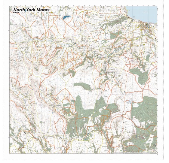
The dramatic North York Moors stretch-out to the North Sea at Whitby in the north east of the map from Wether Cote and Gillamore in the south west.
KEY INFORMATION:
Major Settlements:
Whitby, Rosedale Abbey, Spouton Moor, Commondale, Cropton Forest, Newton on Rawcliffe
National Grid Coordinates (Easting, Northing / Grid Reference):
Lower-left 464000, 487000
Upper-right -491600, 514600
Scale:
1:40,000
Dimensions on map:
27.6km x 27.6km
Size of product (including borders):
72cm x 72cm (approximately)