SplashMaps are weatherproof maps of fabric. These light-weight, durable, washable, wearable fabric maps and are ideal for the real outdoors of mud, wind, snow and rain
all the conditions that paper is not cut-out for. This is a fresh new market offering, never done before; uniquely based upon the best
Ordnance Survey data and other
Open Data Sources. We are able to tailor these maps to be the most usable outdoor maps ever for walking, riding, cycling, eventing or anything you could do in the real outdoors.
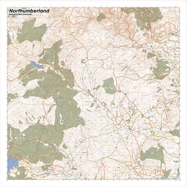
The Map is designed for outdoor adventures and features contours, the OS national grid, walking and riding trails, clearly designated and numbered roads and water bodies. Our signature pub, car park, church and camping symbols make navigating to your start and end points a doddle.
National Grid Coordinates (Easting, Northing / Grid Reference):
Lower-left - 369000, 585000 / NY690850
Upper-right - 396600, 612600 / NT966126
Scale:
1:40,000
Dimensions on map:
27.6km x 27.6km
Size of product (including borders):
72cm x 72cm (approximately)