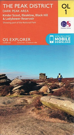
Famous for its vast exposed moorlands, waves of plateauing gritstone,
feather bed bogs covered in cotton grass, and heather moors. Below the
moorland are oak-birch woods and steep valleys covered in interlocking
blocks of coniferous plantation - a picturesque place of tranquillity.
Our
OS Explorer maps are perfect for day-tripping, extensive hikes, and
cycling.
Highlights of the area include:
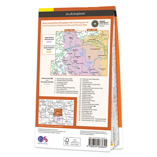
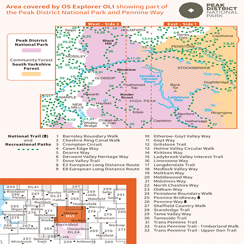
Pennine Way
Pennine Bridleway
Gritstone Trail
Limestone Way
Middlewood Way
Cheshire Ring Canal Walk
Kirklees Way
Dearne Way
Holme Valley Circular Walk
Oldham Way
Goyt Way
Longdendale Trail
Cown Edge Way
Medlock Valley Way
Standedge Trail
Crompton Circuit
Hills and Hamlets Walk
Midshires Way
Dove Valley Trail
Barnsley Boundary Walk
Tameside Trail
Etherow-Goyt Valley way
Penistone Boundary Walk
Trans Pennine Trail
Ladybrook Valley Interest Trail
Tame Valley Way
Derwent Valley Heritage Way
Elsecar to Wortley Trail
Pennine Way (National Trail)
E2 (European Long Distance Route)
Pennine Bridleway (National Trail)
Cheshire
Peak District National Park
West Yorkshire
Greater Manchester
South Yorkshire
Derbyshire