The OS Explorer Map Series is 4cm to 1km (2½ inches to 1 mile) scale and is the main stay used by many individuals and organisations involved in outdoor activities. It is the preferred choice for walkers, hikers, trekkers, climbers, mountain bikers, cyclists, horse riders and even water sports enthusiasts.
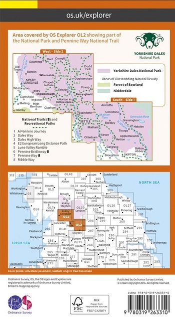
Explore the lush green valleys of the South and West Yorkshire Dales,
divided up by limestone scars and towering fells. Whether youre up for
an energetic outdoor expedition, or some gentle exploration of the
areas geological features, the OS Explorer OL2 map of the South and
West Yorkshire Dales is all youll need to plot and navigate your route.
With every detail of the countryside clearly marked from rivers to
rights of way, pubs to viewpoints no matter what your map reading
experience, youll have no trouble following the signs and symbols.
Take
on the challenge of the Yorkshire Three Peaks Whernside, Ingleborough
and Pen-y-ghent. And clock back in to the café in Horton in less than
12 hours for a congratulatory cuppa and souvenir.
If youd prefer a gentler day out, why not opt for a narrow boat cruise on the Leeds-Liverpool Canal?
Or if the middle grounds where you feel most at home, the
spectacular views from the shores of Malham Tarn offer more than just
reward for the moderate walk. Discover gushing waterfalls and
fascinating wildlife in the setting that inspired Charles Kingsley to
write The Water Babies.
Whatever your outdoor pursuits passion, make sure you dont miss out
on any of the natural wonders of the South and West Yorkshire Dales.