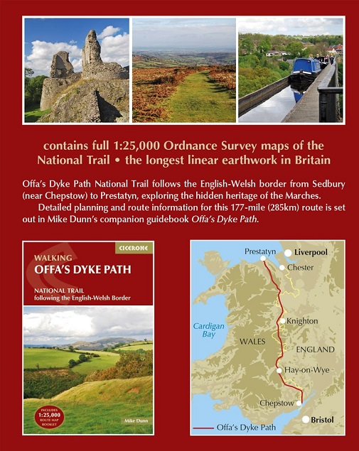
All the mapping you need to walk the Offa's Dyke Path National Trail
that runs for 177 miles along the English-Welsh border between Sedbury
(near Chepstow) and Prestatyn on the north Wales Coast.
NOTE An accompanying Cicerone guidebook - Offa's Dyke Path -
describes the full route from south to north with lots of other
practical and historical information. The accompanying guidebook
INCLUDES a copy of this map booklet.
This booklet of Ordnance Survey 1:25,000 Explorer maps is
conveniently sized for slipping into a jacket pocket or top of a
rucksack and comes in a clear PVC sleeve. It shows the full and
up-to-date line of the Offa's Dyke Path, along with the relevant extract
from the OS Explorer map legend.
Stage 1 Above the Lower Wye Gorge
Stage 2 Sheep and cider in remote Monmouthshire
Stage 3 Crossing the Black Mountains
Stage 4 Gladestry and Hergest Ridge
Stage 5 The Radnorshire Hills
Stage 6 Ups and downs in deepest Shropshire
Stage 7 The Vale of Montgomery and Long Mountain
Stage 8 Across the Severn valley
Stage 9 Exploring the unknown Marches
Stage 10 The Vale of Llangollen and Eglwyseg Rocks
Stage 11 The Clwydian Range
Stage 12 Northern hills and coast