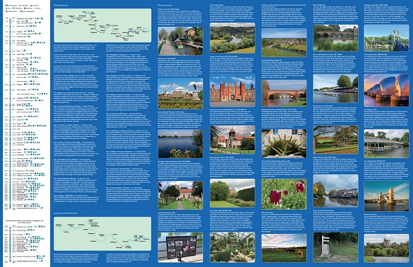
Highlights of this Planning Map include:
- More
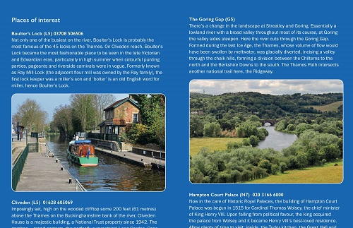
than 20 highlighted places of interest with detailed descriptions and
attractive photographs, including: Tower Bridge, Hampton Court Palace,
and Kew Gardens
- A comprehensive index to more than 800 cities, towns and villages
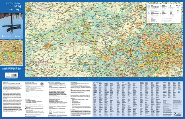
- A clear, visible route plotted across the map
- Advice on safety and security when travelling along the route, as well as the countryside code and the code of conduct
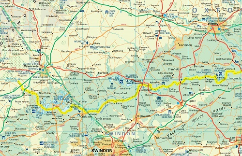
Part
of the National Trail network, this long distance footpath covers 184
miles (296 km) and follows the length of Englands longest river, the
Thames, from its source in the Cotswolds to the Thames Barrier in
Greenwich, London.
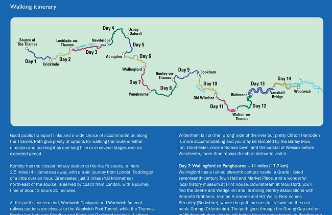
A suggested walking itinerary makes it easy for users
to plan their journey along this popular route.