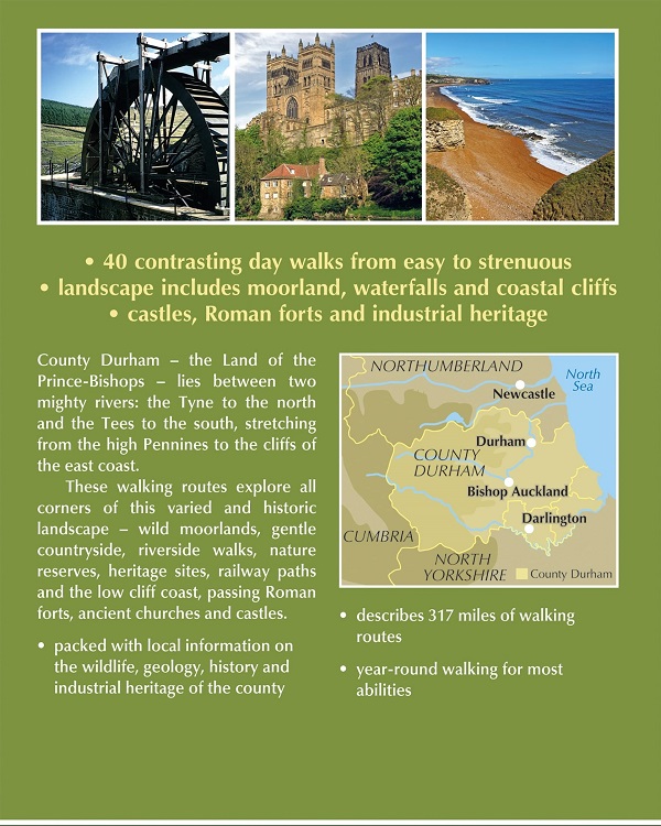
This guidebook contains 40 routes exploring all parts of County Durham. Ranging from 5 to 24km in length, the walks encompass wild moorland, rolling pastures, riverbanks and the low cliff coast. With such a range of possibilities, there are walks here for all abilities, from easy wanders to more challenging days in the hills.
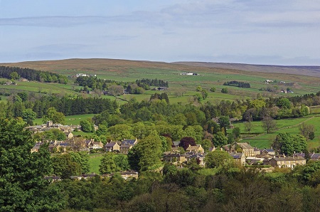
Roman forts, ancient churches and castles are found in a rich, varied and wonderfully scenic landscape. Solid stone villages encircle extensive greens, while on the high Pennines, vast tracts of moorland are now designated as 'open access'.
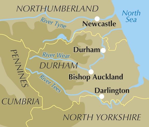
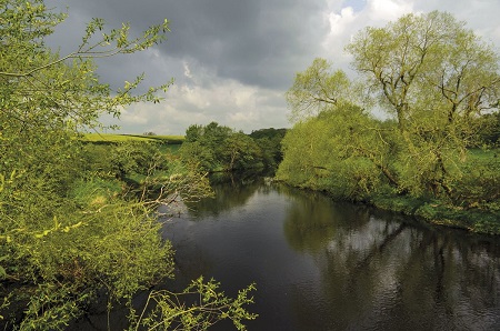
County Durham lies between two mighty rivers - the Tyne to the north and the Tees to the south. The county stretches from the high Pennines in the west to a low cliff coast in the east.
As well as detailed route descriptions and annotated OS maps for every route, the guidebook includes useful practical information, from distance, ascent and terrain information, to refreshments along the way and public transport access.
In addition, the guide provides advice on preparation and how to get to and around County Durham, as well as details on the geology, history, wildlife and points of interest along the way.
Welcome to Walking in County Durham the Land of the Prince-Bishops.
** SAVE £4 ON RRP **
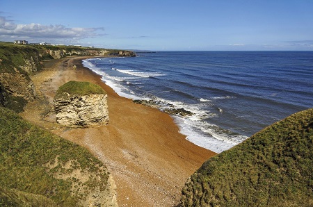
Walking Routes
|
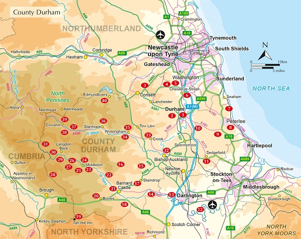
| 1 Durham City and the River Wear |
| 2 Bearpark, Broompark and Brandon |
| 3 Dipton and Hamsterley Mill |
| 4 Beamish and Causey |
| 5 Ouston and Urpeth |
| 6 Lumley Castle and Great Lumley |
| 7 Durham Coast Path |
| 8 Castle Eden Dene |
| 9 Wingate and Station Town |
| 10 Cassop and Quarrington |
| 11 Sedgefield and Hardwick Hall |
| 12 Middleton One Row and Girsby |
| 13 Low and High Coniscliffe |
| 14 Gainford and Piercebridge |
| 15 Cockfield Fell and Butterknowle |
| 16 Woodland and Copley |
| 17 Staindrop and Cleatlam |
| 18 Greta Bridge and Brignall Banks |
| 19 Tan Hill and Sleightholme Moor |
| 20 Bowes and Bowes Moor |
| 21 Barnard Castle and the Tees |
| 22 Cotherstone and Romaldkirk |
| 23 Tees Railway Walk |
| 24 Middleton and Monks Moor |
| 25 Middleton and Grassholme |
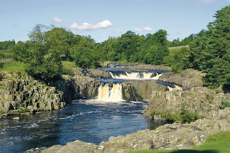
| 26 Low Force and High Force |
| 27 Holwick and Hagworm Hill |
| 28 Mickle Fell via the Boundary Route |
| 29 Cronkley Fell |
| 30 Cow Green and Widdybank Fell |
| 31 Cow Green and Herdship Fell |
| 32 Bishop Auckland and Binchester |
| 33 Circuit of Crook |
| 34 Wolsingham and Frosterley |
| 35 Wolsingham and Tunstall Reservoir |
| 36 Stanhope and Stanhope Dene |
| 37 Westgate, Middlehope and Rookhope |
| 38 Chapelfell Top and Noon Hill |
| 39 Cowshill, Killhope and Allenheads |
| 40 Edmundbyers and Edmundbyers Common |