The 72 mile (116km) Ribble Way is described in seven stages, ranging
from 8.25 to 17 miles (13.3 to 27.4km). The route follows the Ribble
valley, from the estuary mouth near Preston to the river's source on Cam
Fell in the Yorkshire Dales. The route might not be the most
challenging of Long Distance routes, but the contrast through a
succession of different landscapes can be immensely satisfying for
novice and experienced walkers alike.
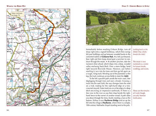
The guide provides detailed route descriptions, OS mapping and a route
summary table, with variants included for day walkers. Information is
included on points of interest along the route, plus there's also
background information on the landscape, wildlife, and history, and
planning details on when to go, where to stay and what to take.
The River Ribble springs from the limestone of the Yorkshire Dales, high
on Cam Fell in the heart of Three Peak country. Initially forcing a
passage between high, rugged moorland hills, it then breaks free to wind
through gentler countryside south of Settle, meandering lazily through
alternating pasture and ancient woodland, where old manor houses and
early 18th-century village cottages still hold sway against the
pervasive tide of modernity.
Beyond Preston, the river dramatically
changes yet again, trained to run straight to the Irish Sea, but further
to the west, a vast expanse of the salt marsh still remains and
attracts huge populations of birds, particularly in winter.
The Ribble Way
Stage 1 Longton to Penwortham Bridge
Stage 2 Penwortham Bridge to Ribchester
Stage 3 Ribchester to Brungerley Bridge
Stage 4 Brungerley Bridge to Gisburn Bridge
Stage 5 Gisburn Bridge to Settle
Stage 6 Settle to Horton in Ribblesdale
Stage 7 Horton in Ribblesdale to the Ribble’s source (and return to Ribblehead)