
To find the book, map or guide you are looking for, first select the area you are interested in by moving your mouse over the map and then click on a region to view our range.


London
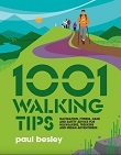
1001 Walking Tips by Paul Besley is a light-hearted and informative guide to all kinds of walking.
Price: £25.00
Price: £17.50


London...so much to see, so much to do, so many amazing routes to walk packed with history, diversity and culture. Make sure you pack this slim line walking guide to discover 50 of the cities best routes of 2 to 10 miles.
Price: £9.99
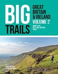
Price: £20.00


This book covers a very large area and includes all of the substantial hills to be found in the South East and Central parts of England. The aim for each book in the series is to contain 50 good hills to ascend, and hence the somewhat expansive coverage from the South Downs up to the beginning of the Pennine Hills.
Price: £12.99

This inspirational new guidebook is the must-have accessory for new parents that want to get outdoors with their little ones. The 50 buggy-friendly walks are easy, with no stiles or other obstacles but all are spectacular walks in their own right.
Price: £16.95

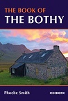
A celebration of 26 of the author's favourite bothies, as she shares her
memories of her favourite 'stone tents' all over the UK in remote and
wild locations. Packed with expert advice on how to make use of these
'free, old, empty houses' from packing lists to bothy etiquette and the
best walks into these remote locations.

Active, happy kids make the best holiday companions, and this
colourful book is brimming with great campsite-based ideas to keep the
little ones interested, entertained - and even a little challenged -
from dawn until dusk.


