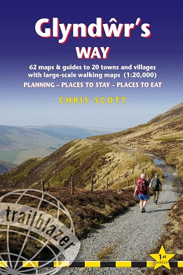
The go-to, all-in-one guide to walking
Glyndŵr's Way, one of Wales' most historic and scenic long-distance
trails, tracing the footsteps of the legendary Welsh leader.
Glyndŵr's
Way is a 135-mile (217 km) National Trail through mid-Wales, tracing
the historic footsteps of Owain Glyndŵr, the leader of a Welsh rebellion
against the English in 1400. The route begins in Knighton, where it
connects with the Offa's Dyke Path, and finishes in Welshpool, crossing a
mix of open farmland, rolling hills, and forested landscapes.
This
fully re-walked and completely updated 1st edition Trailblazer guide is
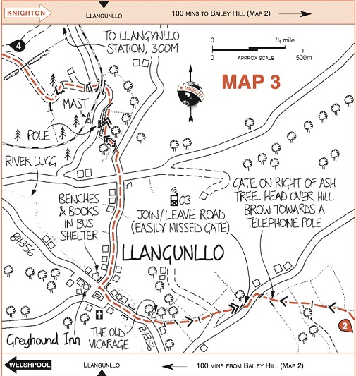
built around what Trailblazer does best: maps that are large-scale,
route-led, based on Ordnance Survey* mapping, that you can follow
directly on the trail. With walking distances and times, accommodation,
food stops and key landmarks shown on the map itself, there is no need
to switch between text, apps or additional maps - everything you need is
in one book.
Ideal for those planning their first multi-day walk and
for experienced hikers, the guide supports walkers who prefer to plan
their own days rather than follow rigid stages.
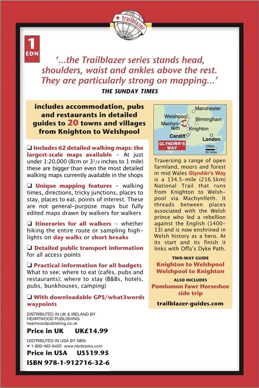
In this Trailblazer guide you'll find:
- 58 large-scale, edited walking maps
(just under 1:20,000), with the added detail you need to walk with the
book in hand so you can walk confidently without switching between apps
or extra maps
- Unique Trailblazer mapping features,
including distances and walking times, clear directions, tricky
junctions, gradients, places to stay, places to eat and points of
interest
- Flexible itineraries for all walkers
- walk the full coast-to-coast route, choose shorter sections, or
sample the highlights. The trail can be walked in either direction, and
this guide supports both options with clear, directional mapping
- Clear stage planning helping you judge daily distances, terrain and ascent to suit your pace
- Detailed public transport information for access to all points along the trail
- Guides to towns and villages
with practical advice for all budgets, including cafés, pubs and
restaurants, plus B&Bs, hotels, hostels, bunkhouses and campsites
- Downloadable waypoints with GPS and what3words references, so you can navigate confidently with or without a device
Route highlights include:
- The northern starting point at Knighton, situated on the England–Wales border
- Rolling hills and historic villages such as Llanidloes, Llanbrynmair, and Llansilin
- Dramatic landscapes across the Cambrian Mountains and scenic high moorland, with notable viewpoints around Dinas Mawddwy
- Historic castles and landmarks including Machynlleth, the political centre of medieval Wales, and surrounding heritage sites
- Charming market towns and river valleys, passing through Welshpool and Llanfair Caereinion
Detailed,
reliable and inspiring, this long-established and regularly updated
Trailblazer guide offers expert advice, excellent mapping, and
everything you need to enjoy Glyndwrs Way, whether it's your first
long-distance walk or your next great walking challenge.
*based on Ordnance Survey mapping (out-of-copyright), fully amended and updated by Trailblazer