
Scotland
North East
North West
Yorkshire
Wales
West Midlands
East Midlands
East
South West
South East
London
To find the book, map or guide you are looking for, first select the area you are interested in by moving your mouse over the map and then click on a region to view our range.


Harvey Maps
The HARVEY map is printed on waterproof paper so rain won't spoil your
plans. The map is light, slim and supple when folded to fit easily into
your pocket.
All of our maps are made with you, the user, in mind. The ground is
field checked by our enthusiastic team of surveyors so you can be sure
that what you see on the map exists in the real world.
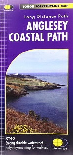
The 200km (125 mile) long Anglesey Coastal Path is a long distance route
that follows much of the island's coastline and comprises one section
of the Wales Coast Path.
Price:
£16.50

New generation HARVEY Superwalker, XT25 waterproof, is designed to be the most practical tool for navigation outdoors.

Arrochar Alps - Superwalker...
HARVEY Superwalker map at 1:25,000 scale. Detailed map for walking, scrambling and climbing.
Price:
£12.95

This HARVEY Superwalker map at 1:25,000 scale is a detailed map of Ben Nevis and is for hillwalkers and climbers covering Fort William through Glen Nevis to Loch Treig.
Price:
£15.95
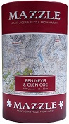
Just when you thought you had run out of ideas for gifts for your walking friends, HARVEY comes up with the MAZZLE - a map jigsaw of your favourite hills.

Ben Nevis British Mountain Map
Printed on polyethylene - durable, tear-resistent and 100% waterproof. Made in cooperation with the British Mountaineering Council and the Mountaineering Council of Scotland. Colour shading for easy identification of hills and valleys. Detailed crag information for climbers.
Price:
£18.95

Detailed map for runners and walkers of Ben Nevis, the Grey Corries and the Mamores at the magic scale of 1:40,000.
Price:
£11.95

Detailed map for hillwalkers of the EASTERN part of the Brecon Beacons National Park at the popular scale of 1:25,000
Price:
£15.95
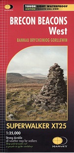
New, Superwalker XT25 of the Brecon Beacons National Park on 2
sheets. Brecon Beacons WEST - This map covers Pen y Fan, Fforest Fawr
and, the Black Mountain in the far west.
Price:
£15.95
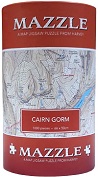
Just when you thought you had run out of ideas for gifts for your
walking friends, HARVEY comes up with the MAZZLE - a map jigsaw of your
favourite hills.

Buy both the Cape Wrath Trail North and Cape Wrath Trail South maps together.
Price:
£35.90

The Cape Wrath Trail is a challenging route from Fort William to Cape Wrath. It is around 200 miles long and passes through some of Scotland's wildest and most spectacular scenery. This map covers the northern section of the route, from Strathcarron to Cape Wrath.
Price:
£17.95

The Cape Wrath Trail is a challenging route from Fort William to Cape Wrath. It is around 200 miles long and passes through some of Scotland's wildest and most spectacular scenery.
This map covers the southern section of the route, from Fort William to Strathcarron. Price: £17.95

Just when you thought you had run out of ideas for gifts for your walking friends, HARVEY comes up with the MAZZLE - a map jigsaw of your favourite hills.

Cheviot Hills Superwalker XT25
Ideal for The Cheviot, Windy Gyle and the northern section of Northumberland National Park. Includes Wooler, Kirk Yetholm, Breamish Valley and Harthope Valley.
Price:
£15.95

NEW - the whole of the Coast to Coast long distance walking route ON ONE MAP.
Price:
£17.95
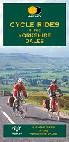
8 SUPERB cycle rides in the Yorkshire Dales varying in length from 11 to 23 miles.
Price:
£6.00
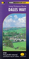
Showing the entire 130km (81 miles) of The Dales Way from Ilkley in
Yorkshire through the Dales via Grassington, Buckden and Dent to Bowness
on Windermere in the Lake District.
Price:
£16.50
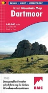
Dartmoor, the latest title in the highly successful and innovative
British Mountain Map series, is the only really detailed map for walking
to cover this famous area on one sheet. XT40 - A new generation of
tough polyethylene maps.
Price:
£18.95

Just when you thought you had run out of ideas for gifts for your
walking friends, HARVEY comes up with the MAZZLE - a map jigsaw of your
favourite hills.
Price:
£25.99

More than a map - an essential piece of equipment.This new generation HARVEY Superwalker is designed to be the most practical tool for navigation outdoors.
Price:
£15.95
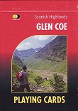
Pack of 52 Playing Cards depicting Glen Coe - a great idea for the map enthusiast!
Price:
£10.99
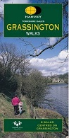
Easy-to-use and clear mapping to 8 superb walks centred on Grassington in the Yorkshire Dales.
Price:
£6.95
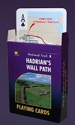
Pack of 52 Playing Cards depicting the Map of Hadrian's Wall Path - a great idea for the map enthusiast!
Price:
£10.99

A perfect map to explore this wonderful walking area in the Yorkshire Dales - 8 walks in mid-Wensleydale and Lower Bishopdale.
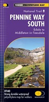
The Pennine Way is a National Trail. It follows the backbone of England from the Peak District to the Scottish borders. It is one of the toughest UK long distance footpaths, and forms part of the European Footpath Network.
Pennine Way South covers the route from Edale to Horton-in-Ribblesdale.
Price:
£16.50

A perfect map to explore in and around Reeth - 8 fabulous walks centred on this lovely Swaledale village.
Price:
£6.95
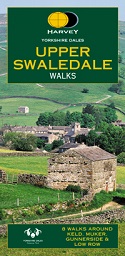
Harvey - Upper Swaledale Walks
Perfect map to explore the fabulous walking area of Upper Swaledale - 8 walks centred around Keld, Muker and Gunnerside.

Harvey BMC North York Moors...
This North York Moors map is a welcome addition to the range of British Mountain Maps published by Harvey Maps in conjunction with the BMC.
Price: £14.50
New concept in outdoor mapping: Maps of the whole of the Lake District National Park in one handy book.
Price:
£9.95
Shopping with us is safe and secure


