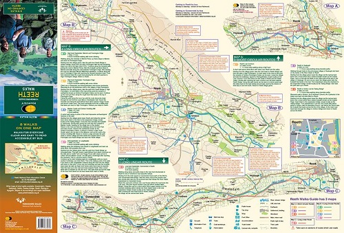
This folded map contains 8 walks centred on Reeth. It includes concise
walking directions for each route as well as Harvey's high quality
mapping at 1:25,000 scale showing field boundaries, so precise
navigation is straightforward.
The routes are highlighted on the maps,
each shown in a different colour and the walks are grouped according to
which of three map sections they are shown on.
There are three short
circular routes of about 3 miles and four long circular routes of 7
miles. In addition there is one long linear walk of 6.5 miles. All the
starting points can be reached by bus.
The walks are:
Reeth Low Common - 2.5 miles
Reeth to Healaugh - 3 miles
Reeth to Grinton via the 'Swing Bridge' - 3 miles
Marrick and Fremington Edge, high level Swaledale - 7 miles
Fremington Edge - high level Swaledale - 7 miles
Maiden Castle and Grinton Smelting Mill - 7 miles
Arkengarthdale to Langthwaite - 7 miles
Gunnerside to Reeth (linear) - 6.5 miles