Call: 0333 335 5474
Basket: £0.00 | 0 items

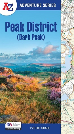
Peak District Dark Peak A-Z Adventure Atlas

Peak District Dark Peak A-Z Adventure Atlas

The A-Z Adventure series is an innovative concept that utilises Ordnance Survey Explorer mapping in a book, therefore eliminating the need to fold and re-fold a large sheet map to the desired area.

Unlike the original OS sheets, this A-Z Adventure Atlas includes a comprehensive index to towns, villages, hamlets and locations, natural features, nature reserves, car parks and youth hostels, making it easy to find the required location quickly. 

Each index entry has a page reference and a six figure National Grid Reference. At a book size of 240mm x 134mm it is the same size as a standard OS Explorer map when closed.

This A-Z Adventure Atlas of the Peak District Dark Peak features 50 pages of continuous Ordnance Survey mapping covering: Peak District National Park (northern part), Kinder Scout, Hope Valley, Hathersage, Castleton, Snake Pass & Derwent Valley.

ISBN 9780008744205
 
OUR PRICE: £11.99
 
Quantity
 
Delivery Info  
Flat rate £2 postage on all items/orders up to £19.99 Free Delivery on orders over £20


Know someone who'd like this? Tell them about it...

*
*
*
Shopping with us is safe and secure
Copyright © Walking-books.com All rights reserved Created by White Room Creations T&C’s I Privacy Policy