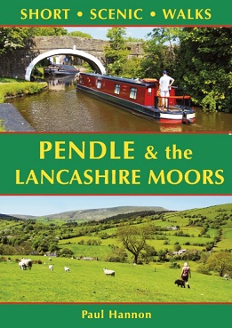
A range of enhancements include a wider geographical spread,
with this book including the area covered in the now superceded Around
Pendle. This title is based around the absorbing countryside of East
Lancashire, from Pendle Hill around to the West PennineMoors.
Starting
from villages such as Barley, Rivington, Hurstwood and Belmont, the
books many highlights include the delights of Newchurch, Winter Hill,
Thieveley Pike, Haslingden Grane and Wycoller Dean.
In
addition to being more visually appealing than their predecessors, with
a more modern house style, this new series offers 30 walks rather than
20, and these more substantial books feature a full spine rather than
wire-stitched binding. Over 30 colour photographs depict features and
landscapes along the routes.
List of Walk Locations
Pendle Hill from Barley - 4.75 miles
Newchurch from Barley - 4 miles
Pendle Water from Barrowford - 3.5 miles
Greenberfield Locks from Salterforth - 4.75 miles
Weets Hill from Barnoldswick - 4.75 miles
Kelbrook Moor from Kellbrook - 4.5 miles
Great Edge from Foulridge - 4.75 miles
Wycoller Dean from Wycoller - 4.25 miles
Boulsworth Hill from Trawden - 4 miles
Extwistle Moor from Thursden - 4.5 miles
Shedden Clough from Hurstwood - 4.5 miles
Thieveley Pike from Holme Chapel - 4.5 miles
Singing Ringing Tree from Crown Point - 3.5 miles
Great Hameldon from Hapton - 4.25 miles
Upper River Irwell from Bacup - 4.5 miles
Allenden Hill from Calderbrook - 3.75 miles
Crook Moor from Wardle - 4.5 miles
Healey Dell from Broadley - 4.5 miles
Cowpe Lowe from Waterfoot - 3.5 miles
Cribden Hill from Haslingden - 4.5 miles
Haslingden Crane from Clough Head - 3.5 miles
Musbury Clough from Helmshore - 4 miles
Peel Tower from Holcombe - 4.75 miles
Turton Tower from Jumbles Country Park - 4.25 miles
Yarnsdale from Entwistle - 4.25 miles
Darwen Tower from Darwen - 4.5 miles
Winter Hill from Belmont - 4.5 miles
Rivington Pike from Rivington - 4.25 miles
White Coppice from Knowley - 4.25 miles
Anglezarke Reservoir from Anglezarke - 4.25 miles