All the mapping you need to complete the Cotswold Way National Trail between Chipping Campden and Bath.
NOTE: An accompanying Cicerone guidebook - The Cotswold Way -
describes the full route in both directions with lots of other practical
and historical information, for those who prefer a written guide. The
accompanying guidebook INCLUDES a copy of this map booklet.
This booklet of Ordnance Survey 1:25,000 Explorer maps has been
designed for convenient use on the trail. It shows the full and
up-to-date line of the Cotswold Way, along with the relevant extract
from the OS Explorer map legend. It is conveniently sized for slipping
into a jacket pocket or top of a rucksack and comes in a clear PVC
sleeve.
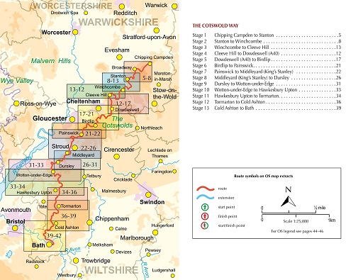
Stage 1 Chipping Campden to Stanton
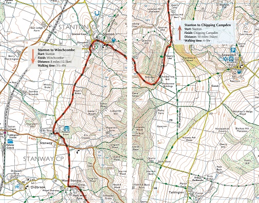
Stage 2 Stanton to Winchcomb
Stage 3 Winchcombe to Cleeve Hill
Stage 4 Cleeve Hill to Dowdeswell (A40)
Stage 5 Dowdeswell (A40) to Birdlip
Stage 6 Birdlip to Painswick
Stage 7 Painswick to Middleyard (Kings Stanley)
Stage 8 Middleyard (Kings Stanley) to Dursley
Stage 9 Dursley to Wotton-under-Edge
Stage 10 Wotton-under-Edge to Hawkesbury Upton
Stage 11 Hawkesbury Upton to Tormarton
Stage 12 Tormarton to Cold Ashton
Stage 13 Cold Ashton to Bath