Wales and the Welsh Borders
With three National Parks this area is one of the most popular destinations in the UK for walkers where mountains and valleys lay side by side with glacial lakes, rivers, scenic villages, and bustling cityscapes to make it a holiday or short break destination with something for everyone.

Pathfinder Guide -...
The mountains of Snowdonia are magnificent featuring row-upon-row of jagged peaks and ridges. However, there is more to Snowdonia than its mountains. The region offers the walker plenty of easier low-level walks through delightful valleys ranging from narrow and steep-sided to green and open.
Price:
£7.99

Pathfinder Guide -...
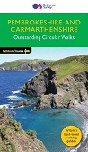
Pathfinder Guides are the perfect companion for country walks throughout Britain. Each title features 28 circular walks with easy-to-follow route descriptions, all tried and tested by seasoned walkers. The routes range from extended strolls to exhilarating hikes, so there is something for everyone.
Price:
£12.99

Pathfinder Guide Anglesey,...
This Pathfinder guidebook provides 145 miles of irresistibly scenic
walking. It features ten circuits on the gorgeous Anglesey coast, six
walks embracing the Wales Coast Path round the Lleyn Peninsula, and
eleven glorious National Park rambles across Snowdonia.
Price:
£12.99
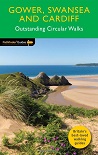
Pathfinder Guide: Gower,...
Each of the titles features 28 circular routes, all tried and tested by seasoned walkers. The routes range from extended strolls to exhilarating hikes, so there is something for everyone.
Price:
£12.99

Pathfinder Guide: GPS for...
This easy-to-use guide, written by experienced mountain leader and navigation trainer Clive Thomas, uses non-technical language to introduce you to choosing and using a gps receiver to enhance leisure walking and make it safer.
Price:
£11.99

Pathfinder Guide: Map...
It makes sense to be safe in the countryside and this companion title to the best-selling Pathfinder and Short Walks series provides a practical and easy-to-use introduction to basic map reading and navigation skills for walkers.
Price:
£11.99

Pathfinder Guide: North...
For 25 years Pathfinder Guides have been the definitive companion to the highways, byways, hills, moors and coastline of Britain. This guide to North Wales & Snowdonia is a full updated edition.
Price:
£12.99
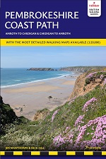
Pathfinder Guide:...
This guidebook contains 150 miles of enthralling walking, following
outstanding circular routes along the Atlantic hugging Pembrokeshire
Coast Path from the spectacular cliff scenery at Dinas Head, via the
superb views over the Marloes Peninsula to the beautiful beaches at
Saundersfoot and Tenby.
Price:
£11.99

Pathfinder Guide: The...
For 25 years Pathfinder Guides have been the definitive companion to the highways, byways, hills, moors and coastline of Britain.
Price:
£11.99

Pathfinder Guide: The...
With 28 circular, graded walks all tried and tested by seasoned walkers,
this walking guidebook for The Malverns and Warwickshire is ideal for
both holidays and locals. The routes discovered in this guidebook are
from 4.8 to 15km (3 to 9 miles), so there's a choice for all abilities.
Price:
£12.99

Peak Bagging: Wales: 49...
In Peak Bagging Wales, local author Will Renwick guides you to
all of the 188 Welsh Nuttalls (hills in England and Wales over 2,000
feet and with a prominence of at least 15 metres). Whether youre a
hillwalker or trail runner, this is the definitive guide to bagging the
best peaks in Wales.
Price:
£22.95

Pembrokeshire - 40 Coast...
As the home of Britain's one and only national coastal park,
Pembrokeshire is rightly famed for its marine wildlife, unspoilt
beaches, towering cliffs and charming harbours.
Price:
£6.99

Pembrokeshire Coast...
Enamel pin featuring the beautiful seaside of the Pembrokeshire Coast National Park in southern Wales.
Price:
£8.00

Pembrokeshire Coast Park...
This full colour walking guidebook contains 20 of the best routes chosen and written by Pembrokeshire Coast National Park Rangers.
Price:
£6.99

Pembrokeshire Coast Path -...
Discover the UK's National Trails and Long Distance Routes with our popular 1:40,000 scale map series. This map shows the entire Pembrokeshire Coastal Path route from St Dogmaels to Amroth on one sheet.
Price:
£12.95

Pembrokeshire Coast Path -...
180 miles of cliff top, beach and cove around the magnificent Welsh
coast, The Pembrokeshire Coast Path (Llwybr Arfordir Sir Benfro) is the
186-mile National Trail around Waless magnificent southern headland.
Price:
£12.99 RRP:
£14.99

Pembrokeshire Coast Path: A...
The Pembrokeshire Coast Path is a 186 mile (299 km) National Trail
in south-west Wales. From Amroth in the south to St Dogmaels in the
north and running mainly through the Pembrokeshire National Park, the
route passes through some of the most scenic parts of Wales.
Price:
£11.99
Pembrokeshire Coast Path:...
The Pembrokeshire Coast Path follows a National Trail for 186 miles (299km) around the magnificent coastline of the Pembrokeshire Coast National Park in south-west Wales. The 6th edition is now out of print.
NEW 7th Edition DUE February 2027
Price:
£13.99 RRP:
£15.99

Pembrokeshire Coast Short...
Britains only coastal national park, explore ten family-friendly
and easy-paced walks along the more accessible and most rewarding
sections. Compromising beautifully rugged shores, the heavily indented
Pembrokeshire coastline has a succession of headlands and bays, striking
cliff formations and sweeping sandy beaches.
Price:
£6.99

Ramble On - The story of...
This fascinating ramble through the history of walking delves into our relationship with the British countryside.
Price:
£10.99

Ridges of Snowdonia - A...
Snowdonias very best ridge walking is described in this guidebook, taking walkers through the Carneddau, Glyders and Tryfan, Snowdon range, Moelwyns, Nantlle, Rhinogs, Arans, Cader Idris.
Price:
£10.95 RRP:
£12.95

Scrambles in Snowdonia - 80...
Guidebook to 80 graded scrambles in Snowdonia, North Wales. This revised
edition of Steve Ashton's classic guide is illustrated with photo
topos, and includes 16 routes selected by the updaters, as well as all
the classic routes including the Snowdon Horseshoe, North Ridge of
Tryfan, Bristly Ridge and the Cneifion and Cyfrwy Arêtes.
Price:
£14.95

Secret Britain - Unearthing...
Secret Britain offers an expertly guided tour of Britains most fascinating mysteries:
archaeological sites and artefacts that take us deep into the lives of
the many different peoples who have inhabited the island over the
millennia.
** Signed copies available **
Price:
£18.00 RRP:
£20.00

Snowdon patch
Range of woven patches celebrating the highest mountains in England, Wales and Scotland; Scafell Pike, Snowdon and Ben Nevis.
Perfect for adding a bit of character to your bag or other bits of gear, while marking your mountain milestones and memories.
Price:
£5.00

Snowdon Playing Cards
Pack of 52 Playing Cards depicting Snowdon - a great idea for the map enthusiast!
Price:
£10.99

Snowdon: Mazzle Map Jigsaw...
Just when you thought you had run out of ideas for gifts for your walking friends, here comes the MAZZLE - a map.
Price:
£25.99

Snowdonia - AA Leisure Map
Aimed at residents and visitors alike, the AA Snowdonia Leisure Map is ideal for planning days out, exploring, and helping visitors to get to know the area.
Price:
£7.99

Snowdonia National Park...
Enamel pin featuring the summit rock formations of Glyder Fach in Snowdonia National Park, Wales.
Price:
£8.00

Snowdonia OS Map Bundle
This OS Map bundle contains all 3 OS Explorer Maps for Snowdonia National Park. Map sheet numbers OL17, OL18 and OL23 in the OS Explorer map series are the ideal maps for exploring the mountains, lakes, woodlands, valleys and coastline of the Snowdonia National Park. SAVE money with this bundle!
Price:
£31.00 RRP:
£38.97

Snowdonia Short Walks Made...
Everybody can explore Snowdonia, from England and Wales highest
mountain to magical medieval castles and the spectacular Conwy
coastline, with these accessible, family-friendly walks. Get outside and
active with the whole family amidst the mysterious legends and natural
beauty of Snowdonia.
Price:
£6.99


