Whether new to recreational walking or an old hand, these routes are a
superb introduction to the Shropshire Hills. The walks vary from 2.5 to
8.5 miles in length. Some cross rolling farmland and leafy woodland,
others traverse the open moors, including magnificent ridge walks with
panoramic views.
Each walk has clear route directions and
1:25,000 scale Ordnance Survey mapping, with local information and
points of historical or environmental interest along the way provided.
Each walk entry begins with practical information including distance and
time, terrain, start point with grid reference, OS Explorer map sheet
number, refreshment option, and public transport details if available.
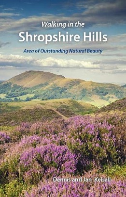
The book is illustrated with numerous colour photographs and includes an
introductory chapter.
The walk locations are:
Earl's Hill - 4 miles
Snailbeach - 6.25 miles
Stiperstones - 5.5 miles
Nipstone Rock - 2.5 miles
Mitchell's Fold Stone Circle and Corndon Hill - 4.75 miles
Ratlinghope and The Portway - 7.5 miles
Carding Mill and The Long Mynd - 6 miles
Ashes Hollow and Pole Bank - 6.5 miles
Caer Caradoc and Hope Bowdler Hill - 6.5 miles
Ragleth Hill and Acton Scott - 7.5 miles
Bishop's Castle and Oakeley Mynd - 7.75 miles
Clun and Bury Ditches - 8.5 miles
Black Hill - 7.25 miles
Knighton and Offa's Dyke - 8.25 miles
Bucknell Hill - 7.75 miles
Craven Arms and Stokesay Castle - 4.5 miles
Titterstone Clee Hill - 4 miles
Brown Clee Hill and Abdon Burf - 6 miles
Wenlock Edge - 6.5 miles
The Wrekin - 7 miles