
To find the book, map or guide you are looking for, first select the area you are interested in by moving your mouse over the map and then click on a region to view our range.


South West
With the 630 mile long South West Coast and both Dartmoor and Exmoor national parks this area offers a superb range of walks.
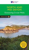
Pathfinder Guide: North and...


For 25 years Pathfinder Guides have been the definitive companion to the highways, byways, hills, moors and coastline of Britain.
Price: £11.99


Secret Britain - Unearthing...


The beautiful Cotswolds, with its rolling hills and pretty little
villages, is perfect walking country. Explore this region with these 20
walks, all of which are 5 miles or under in length and can easily be
completed in less than 3 hours.


There's a lot more to Somerset than scrumpy cider, cheddar cheese and the Glastonbury Festival.

The circular routes vary in length from 1¾ and 5½ miles and give dogs
and their owners the chance to explore the county's beautiful
countryside


This is a brand new pocket sized map of the National Cycle Network centred around the Somerset Levels.
Price: £7.99
This is a brand new pocket sized map of the National Cycle Network in South Devon.
Price: £4.99
This volume covers the 180-mile section of the South West Coast Path running from Falmouth to Exmouth which includes some of the finest coastal scenery in Britain - stunning cliff-top vistas, vast estuarial wetlands and idyllic Cornish coves.
Price: £12.99
The South West Coast Path is the spectacular 630-mile (1008 km) National Trail around the tip of Britain. This volume features the section of the Path from Padstow in north Devon, famous these days for Rick Stein's seafood restaurant, all the way round to Falmouth on the south coast, a distance of 169 miles (271 km).
Price: £12.99
South West Coast Path - set...
SAVE £5 and get FREE postage when you buy the 3 map set of HARVEY South West Coast Path route maps to cover the whole of the National Trail from Minehead to Pool.
Price: £38.50
South West Coast Path North...
The perfect companion for those who love the great outdoors, the A-Z Adventure Series features OS 1:25000 scale mapping in a convenient book, complete with index.
Price: £8.95
The South West Coast Path is perhaps the UKs ultimate challenge for the long distance hiker - a 630 mile (1,014 Km) adventure around the coastline of Englands southwest peninsula. You dont have to walk it all at once though !
SAVE money with this bundle of SEVENTEEN Explorer maps that cover the whole of this classic walk. Price: £186.83
This unique map covers all 630 miles of the UKs longest and best-loved National Trail broken down into 52 easy to walk sections as suggested by the SW Coast Path Association.
Price: £19.99
South West Coast Path South...
The perfect companion for those who love the great outdoors, the A-Z Adventure Series features OS 1:25000 mapping in a convenient book, complete with index.
Price: £8.95


Price: £16.50


