


This guidebook includes over 30 walks to the Jurassic Coast of Devon and Dorset. Stretching between Exmouth and Bournmouth, with some routes venturing inland, the walks range from short easy strolls, to longer challenging walks. The spectacular geology is brought to life with clear cross-sections and timelines.

Guidebook to walking the King Charles III England Coast Path: North West
National Trail. Between Gretna and Chester, this 590km (367 mile) route
explores the Cumbria, Lancashire and Merseyside coast in 27 stages and
can be walked in 1 month. Includes 1:50,000 OS mapping.
Part of the Walking the Lake District Fells series, this guidebook covers a wide range of routes to
28 Lakeland summits that can be climbed from the Borrowdale and Thirlmere valleys - both easily accessed from Keswick - with highlights including Catbells, Great Gable and Scafell Pike.
Part of the Walking the Lake
District Fells series, this guidebook covers a wide range of routes to
32 Lakeland summits that can be climbed from the Buttermere, Lorton and
Newlands valleys, with highlights including Haystacks, High Stile,
Grasmoor and the fells of the Coledale Round. Suggestions for longer
ridge routes are also included.
Price:
£12.95 
Part of the Walking the Lake District Fells series, this guidebook covers a wide range of routes to
24 Lakeland summits that can be climbed from Coniston, Torver, the Duddon valley and the Birker Fell road.
If you are collecting summits in the Lake District, then the series of
eight guidebooks by Mark Richards will give you details of all the fells
and all the routes.

This guide describes ascents of 25 Lake District fells that can be climbed from Langdale and the Vale of Grasmere.

This guide describes ascents of 36 Lake District fells that can be climbed from the valleys of Mardale (Haweswater), Kentmere and Longsleddale and from the east side of Ullswater.
Part of the Walking the Lake District Fells series, this guidebook covers a wide range of routes to
35 Lakeland summits that can be climbed from Ambleside, Grasmere and Patterdale and the Thirlmere and Ullswater valleys, with highlights including Helvellyn and Fairfield.
Price:
£12.95 
This guide describes ascents of 25 Lake District fells that can be climbed from the valleys of Wasdale, Eskdale and Ennerdale.

Walking the Munros is part of a two-volume describing challenging and
inspiring routes to climb Scotland's 282 iconic 3000ft+ mountains. This
volume covers the northern Highlands (north of the Great Glen), the
Cairngorms and Isle of Skye.

Volume 1 of a two-part set, this guide details 69 exciting and challenging routes to climb 139 Munros – the Scottish mountains over 3000ft. Suitable for those with experience of mountain walking, some routes require scrambling while others include the option to cycle a section of the journey.
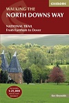
Walking the North Downs Way...
Guidebook to walking the North Downs Way National Trail, a 130 mile
(208km) trail between Farnham and Dover, with an optional visit to
Canterbury. Following the ancient Pilgrim's Way for much of the way,
through pleasant countryside, this is one of the easier National Trails
and the walk is described over 11 stages. With 1:25K OS map booklet.
Price: £15.95

This guidebook offers 50 circular walks in seven regions throughout the North York Moors National Park, enabling walkers to discover and appreciate in turn the Tabular Hills, Hambleton Hills, Cleveland Hills, Northern Moors, High Moors, Eastern Moors and Cleveland Coast.

This guidebook describes the Pembrokeshire Coast Path National Trail.
The scenic 180-mile long-distance walk from Amroth to St Dogmaels takes
around two weeks to walk, with soaring rugged cliffs, tranquil inlets
and broad sandy beaches. With planning schedules, route description and
accommodation guidance. Includes a 1:25K OS map booklet.

Guidebook to the Pennine Way National Trail with OS map booklet. The 270
mile route from Edale to Kirk Yetholm takes three weeks to walk and is
suitable for fit and experienced long distance walkers. The route
crosses the Peak District, Yorkshire Dales and North Pennines National
Parks. Includes separate OS 1:25,000 map booklet of the route.

Walking the Pennine Way Map...
Map of the 265 mile (426km) Pennine Way National Trail, between Edale in
the Peak District and Kirk Yetholm in the Scottish Borders. This
booklet is included with the Cicerone guidebook to the trail, and shows
the full route on OS 1:25,000 maps. This popular long-distance route
typically takes three weeks to complete.
DUE March 15th - pre order now and have your copy sent immediately on publication.
Price:
£12.95 
This guidebook describes an ancient pilgrimage route in southern England
from Winchester in Hampshire, or Southwark, London to Canterbury, a
133-mile walk through wood and farmland, with views across the Weald.
Divided into stages of about 10 miles, with route summary and
information on public transport, accommodation and places of interest.
Price: £10.95

Guidebook to walking the Ribble Way, a 72 mile route following the Ribble valley, from the estuary mouth near Preston to the river's source on Cam Fell in the Yorkshire Dales. The book contains OS map extracts and full route description split into 7 convenient stages, with suggestions for day walkers.
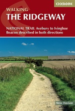
Guidebook to the Ridgeway National Trail, an 87-mile (139km) route
through the south of England from Avebury in Wiltshire to Ivinghoe
Beacon in Buckinghamshire. Accompanied by a pull-out 1:25K mapping
booklet, this guidebook details the trail in both directions and
features information on historic sites and facilities along the way.


