North East including Durham and Northumberland
North East England is a perfect walking destination offering walking experiences as diverse as its rich and varied landscapes.

Walk Britain - 90...
Walk Britain by Elise Downing is an inspirational collection of
90 walking routes accessible by public transport which can enable you
to see the best of England, Scotland and Wales in an environmentally
friendly way.
Price:
£20.00

Walk Hadrian's Wall -...
This challenge to walk Hadrian's Wall from coast to coast is one of the goals of many people. Breathtaking scenery, fresh air and a sense of freedom are what you get when you walk the 84 miles from Bowness-on-Solway to Wallsend. You pass forts, milecastles and turrets along with numerous other historical sites on route.
Price:
£6.50

Walk: Tales, Trivia and...
A leisurely ramble through the woods, a meandering city stroll, a
blustery seaside promenade or a vigorous mountain hike all have their
delights and incomparable joys.
Price:
£9.95

Walking Class Heroes -...
The twentieth anniversary of the Countryside & Rights of Way (CRoW) Act in 2020 provides a good opportunity to look back on the doughty band of campaigners who fought for so long to give ramblers their cherished right to roam.
Price:
£9.99

Walking guide to the County...
There are many hill walking challenges in England and Wales, they include visiting the top of every one of the Lake District peaks or the summits of all the mountains over 2000 feet, but the one that is accessible to all, is to stand on the high point of a county or several counties.
Price:
£9.99

Walking Hadrian's Wall...
This is the new 2023 edition of Mark Richards's superb Hadrians Wall Path guidebook
to walk the 135km (84 mile) National Trail. Described in both
directions, the main description is west to east between
Bowness-on-Solway and Wallsend, Newcastle, with an extension to South
Shields. With extensive historical information related to this World
Heritage site and separate 1:25,000 OS map booklet included.
Price:
£15.95 RRP:
£17.95

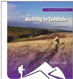
Walking in County Durham
This popular guidebook to walking and cycling in County Durham, in the
north east of England, describes 450 miles of walking routes and
cycleways.
** SAVE £4 ON RRP **
Price:
£10.95 RRP:
£14.95

Walking in Northumberland -...
Guidebook to walking in Northumberland. 36 graded walks of 4 to 14 miles, from the beautiful coast with its immense, empty beaches and dramatic, crag-top castles to the remote hills of the Cheviots and Pennines. Includes Hadrian's Wall, Lindisfarne Priory, Kielder, Berwick, Bamburgh and Dunstanburgh Castles and more.
Price:
£12.95 RRP:
£14.95
Walking in Teesdale
A 116 page full colour A5 booklet describing nine walks and the history and landscape surrounding those walks, through the length of the Teesdale valley.
Price:
£9.99

Walking in the Allendales
A 112 page full colour A5 booklet describing nine walks, and the history and landscape of the East and West Allendale valleys in Northumberlands North Pennines.
THIS TITLE IS TEMPORARILY UNAVAILABLE
Price:
£9.99

Walking in the North...
This guidebook describes 50 day walks across the North Pennines,
England's remotest Area of Outstanding Natural Beauty taking in parts
of Cumbria, County Durham and Northumberland. Most of the routes are
circular and they range from 5 to 14 miles, with something to suit all
abilities.
Price:
£10.95 RRP:
£12.95

Walking in the Scottish...
Guidebook presenting 45 day walks and one long distance route in the Scottish Borders. The day walks cover five areas: the Cheviots, Tweeddale, the Ettrick Hills, Moffat Hills and Manor Hills. The walks are a mixture of high and low level routes and can be fully customised using multiple variants.
Price:
£12.95

Walking in the Simonside Hills
A 112 page full colour booklet describing nine walks, and the history and landscape of the Simonside Hills, a sandstone ridge that stretches from Coquetdale to Redesdale in Northumberland.
Price:
£9.99

Walking in Weardale
A 112 page full colour A5 booklet describing nine walks and the
history and landscape surrounding those walks, through the length of the
Weardale valley.
THIS TITLE IS TEMPORARILY UNAVAILABLE
Price:
£9.99

Walking in Weardale Book 2
A 112 page full colour A5 booklet describing nine walks, and the history and landscape surrounding those walks, through the length of the Weardale valley.
THIS TITLE IS TEMPORARILY UNAVAILABLE
Price:
£9.99

Walking St Cuthbert's...
Guidebook to St Cuthbert's Way, stretching 100km (62 miles) from Melrose Abbey in the Scottish Borders to Holy Island (Lindisfarne) off the Northumberland coast.
Price:
£14.95 RRP:
£16.95

Walking St Oswald's...
This superb new guidebook from Rudolh Abraham describes the St Oswald's Way and Northumberland Coast Paths, both long-distance trails through Northumberland.
Price:
£14.95 RRP:
£16.95

Walking the Border - A...
In this book Ian Crofton makes a journey on foot from Gretna Green in the southwest to Berwick in the northeast, following as close as possible the Anglo-Scottish Border as it has been fixed since the union of the crowns in 1603.
Price:
£16.99

Walking The End to End...
A practical guidebook for
walking from Land's End to John o' Groats. The 1956km (1215 mile)
long-distance route, known as the End to End Trail, follows paths and
tracks rather than road, and takes to the hills whenever it can. The
route is presented in 61 daily stages averaging just less than 32km (20
miles).
Price:
£17.95 RRP:
£19.95

Walking the Literary...
Walking the Literary Landscape brings the two together in a collection of 20 circular routes in the north of England, all between 3 and 9 miles (5 and 15 kilometres) in length. The walks explore the physical settings that inspired some of our greatest literature.
Price:
£12.95

Walking the Northumberland...
This title presents an unique opportunity to discover and explore the lesser-known landscapes of the Northumberland Dales - a land of far horizons and secret corners.
Price:
£8.95

Walking the Pennine Way -...
Guidebook to the Pennine Way National Trail with OS map booklet. The 270
mile route from Edale to Kirk Yetholm takes three weeks to walk and is
suitable for fit and experienced long distance walkers. The route
crosses the Peak District, Yorkshire Dales and North Pennines National
Parks. Includes separate OS 1:25,000 map booklet of the route.
Price:
£15.95 RRP:
£17.95

Walking Through Spring
Walking Through Spring follows Graham Hoylands journey as he creates a
new national trail, walking with the Spring from the south coast in
March up to the border with Scotland, which he reaches on the longest
day: the twenty-first of June.
Price:
£14.99 RRP:
£16.99

Walks for all Ages: County...
Including Ordnance Survey mapping and superbly priced at just £4.99, Walks for all Ages - 20 Circular Walks in County Durham is the perfect accompaniment for a stroll in the county.
Price:
£6.99

Walks for all Ages:...
Including Ordnance Survey mapping and superbly priced at just £4.99, Walks for all Ages - 20 Circular Walks in Northumberland is the perfect accompaniment for a stroll in the area.
Price:
£5.99

Walks for all Ages:...
Including Ordnance Survey mapping and superbly priced at just £4.99, Walks for all Ages - 20 Circular Walks in Scottish Borders is the perfect accompaniment for a stroll in the area.
Price:
£6.99

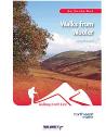
Walks from Kirknewton
The community of Kirknewton lies on the north eastern edge of the Cheviot Hills. Now a tranquil oasis, this area has a long and varied history, much of it steeped in bloodshed that runs from the ancient Celts to the Border Reiver.
Price:
£8.50

Walks from Stanhope
96 page, full colour A5 book describing eight walks across the valley and moors of Weardale, starting and finishing from Stanhope.
Price:
£8.50
Walks from Wooler
The second edition of this popular book is now available. With a revised layout and even more photos to help guide the walker this publication has now been expanded to 104 pages.
Price:
£9.99
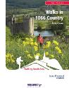
Walks in 1066 Country
In this series of 14 walks, the author uses his considerable local knowledge to offer a rich choice of routes spread across 1066 Country which should enable you to enjoy this magnificent countryside at its very best !
Price:
£10.99


