North East including Durham and Northumberland
North East England is a perfect walking destination offering walking experiences as diverse as its rich and varied landscapes.
Photographer's Guide...
The stunning Northumberland Coast has some of the finest photography
locations in the UK, with romantic castles, miles of glorious golden
beaches, elegant grass-covered dunes and dramatic shoreline geology.
Price:
£12.95

Ramble On - The story of...
This fascinating ramble through the history of walking delves into our relationship with the British countryside.
Price:
£10.99

River Tyne Trail 2nd...
This NEW and enlarged official walking guide covers the three sections of the
walk, from the source of the " North Tyne at Deadwater, the source of
the South Tyne in the Pennine Hills and the course of the unified River Tyne from Warden to the coast.
Price:
£13.99
Sandstone Way - Official...
The Sandstone Way is a new 120 mile (approx) mountain biking route between Berwick upon Tweed and Hexham in North Northumberland. It links, and is named after, the numerous sandstone features, crags and outcrops which are characteristic of the region.
Price:
£7.99

Sea to Sea Cycle Route Map
The official route map and information covering the 136miles/219km of National Cycle Network between Whitehaven or Workington and Sunderland or Tynemouth. Full colour fold-out map, printed on waterproof paper.
Price:
£8.99

Secret Britain - Unearthing...
Secret Britain offers an expertly guided tour of Britains most fascinating mysteries:
archaeological sites and artefacts that take us deep into the lives of
the many different peoples who have inhabited the island over the
millennia.
** Signed copies available **
Price:
£18.00 RRP:
£20.00

Short Scenic Walks -...
The principle feature is that all walks are less than five miles in length, offering a perfect half days stroll for families, casual walkers and all who want to enjoy a leisurely exploration of Britains outstanding country landscapes.
Price:
£4.99

Short Walks Hadrian's...
Short Walks on Hadrian's Wall contains 15 of the best short walks in the area, chosen by local expert, Mark Richards.
Price:
£9.95

Short Walks in...
Discover 15 of the best short walks around Wooler, Rothbury, Alnwick and
the Northumberland coast. Each comes with easy-to-read Ordnance Survey
maps, route description and lots of images, plus information on beauty
spots and refreshment stops. No challenging terrain or complicated
navigation means walks can be enjoyed by everyone.
Price:
£9.95

Short Walks in Northumbria...
One in a series of guides from Collins Ramblers describing 20 easy walks of 5 miles or less in length. All the walks are suitable for families, they feature Ordnance Survey mapping and are described in some detail - full colour throughout.
Price:
£6.99

St Cuthbert's Way -...
Follow the footsteps of St Cuthbert in this easy-going walk of 62 miles (100 km) from Melrose Abbey in the Scottish Borders to the Holy Island of Lindisfarne in the North Sea.
Price:
£11.99

St Cuthbert's Way: The...
This 100k (60 mile) walk was opened in 1996 and has rapidly increased in
popularity, with thousands of walkers walking all or parts of it every
year.Third Edition.
Price:
£16.99

Teesdale Way Pocket Guide
Your essential guide to the Teesdale Way in one handy, spirally-bound
book. Over 120 pages packed with information, directions, custom maps
& colour photos. Make the most of your journey and dont start
without it!
* NOTE - this guide is being updated and will be available again shortly. *
Price:
£11.99

The Book of the Bivvy -...
A guide to the bivouac - the pinnacle of minimalist wild-camping. Accounts of bivvybag adventures,
both nice and nasty, alternate with practical chapters on lightweight kit and long-distance bivvying, and the book finishes with a selectionof bivvybag expeditions. Informative, honest and highly entertaining!
Price:
£9.95

The Cheviot Hills
The second edition of this popular book is now available.
With a revised layout and even more photos to help guide the walker this publication has now been expanded to 88 pages.
Price:
£8.50

The Coast to Coast Walk - A...
Originally devised by the legendary Alfred Wainwright, the
Coast-to-Coast Walk has steadily become one of Britain's most popular
long-distance walks, and it is not hard to see why.
Price:
£14.99
The Complete Guide to the...
The official guide to the UK's 15 beautiful National Parks and how to
discover, explore and enjoy these unique and treasured outdoor spaces.
Price:
£22.00

The Hills of Upper Coquetdale
The second edition of this popular book is now available. With a revised layout and even more photos to help guide the walker this publication has now been expanded to 104 pages.
Price:
£8.50

The Last Hillwalker - A...
The Last Hillwalker by bestselling author John D. Burns is a
personal story of falling in and out of love with the hills. More than
that, it is about rediscovering a deeply felt need in all of us to
connect with wild places.
Price:
£9.99
The Ordnance Survey Puzzle...
Are YOU the ultimate map-reader?
Do you know your trig points from your National Trails? Can you calculate using contours? And can you fathom exactly how far the footpath is from the free house?
Price:
£14.99

The Ordnance Survey Puzzle...
The previous version of the Ordnance Survey Puzzle Book was the
biggest-selling puzzle book of 2018. This all new version is bigger
and more challenging than before, with all new puzzle types from the
simple to the fiendish.
Price:
£12.99 RRP:
£14.99
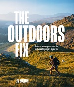
The Outdoors Fix: Stories...
Packed with stunning photographs and practical tips encompassing
everything from after-work local adventures to spending a night out on
the hills, The Outdoors Fix might just provide the inspiration you need to embrace the great outdoors and live more adventurously.
Price:
£20.00
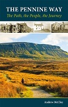
The Pennine Way - the Path,...
A portrait of the The Pennine Way, Britain's oldest and best known
long-distance footpath, stretching for 268 miles from the Derbyshire
Peak District to the Scottish Borders. It charts the path's remarkable
history, and walkers past and present relate their experiences of this
commanding, exhilarating and complex path.
Price:
£10.95 RRP:
£12.95

The Wainwrights in Colour...
The book of the successful and unique Wainwrights in Colour project by Andy Beck is now available. It features all of the 214 Lakeland Fells and all of the 1500+ watercolour sketches which Andy has produced to complete this body of work.
It is a
limited edition of only
5000 signed and numbered copies.
Price:
£39.00
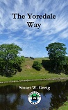
The Yoredale Way
The Yoredale Way is a long distance walk that follows the course of the
River Ure, from its source on the high fells in the Yorkshire Dales
National Park above Kirkby Stephen, to the village of Boroughbridge 73
miles later.
Price:
£10.00

Traffic-Free Cycle Trails -...
Superb guide contains over 400 cycle routes in Great Britain. First published in 2004
and regularly updated ever since, it has become one of the countrys
most popular cycling books, and this fourth edition published in 2020
features a large number of updates and revisions.
Price:
£15.99 RRP:
£17.99

Trekking the Hadrian's...
The Hadrian's Wall path is one of Englands official 'National Trails'.
It leads you on an unforgettable journey of discovery along the route of
the Wall. Discover the incredible surviving sections of the Wall and
its forts, milecastles and turrets.
Price:
£14.99

UK National Parks Scratch...
All 15 National Parks, plus an extra 30
squares to scratch off, and 60 free to visit places labelled to help you
plan your adventures!
Price:
£19.99

Ultimate C2C Guide - Coast...
A completely new, fully updated edition of the best selling guide to the UK's premier long distance cycle route - around 140 miles of superb scenery, from the Irish Sea to the North Sea, taking in the Lake District and the Northern Pennines on the way.
Price:
£11.95

Wainwright Memories
Wainwright Memories
chronicles three little-known stories involving Alfred Wainwright.
Written by Chris Butterfield, it is based on reminiscences by publisher Andrew
Nichol and includes illustrative maps by Chris Jesty.
A remarkable gift or collectors item with signed copies available.
Price:
£24.99


